Talking Map App
Powerful and fast mapping engine
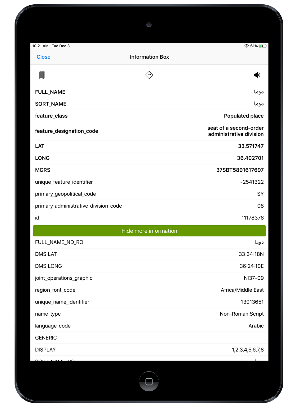
includes worldwide GeoNames Database with audio recordings of the pronunciations in English.
and Elevation, What3Words, PlaceCodes added to each record.
We are selling custom versions of this app
White Labeled Solutions and even selling source code
Native iOS app with NGA Foreign GeoNames Database
Available for each Country with Offline data
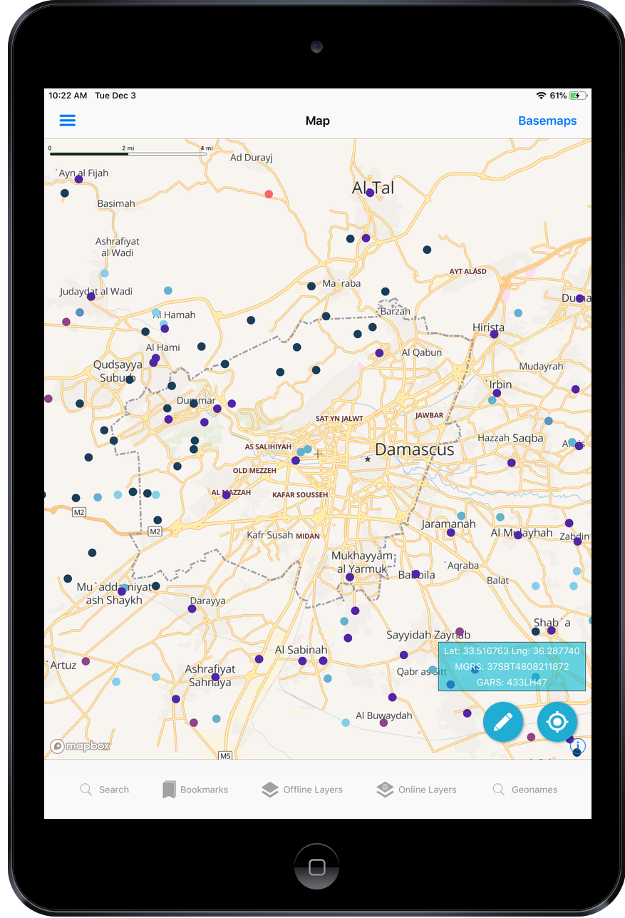
Special Map Features
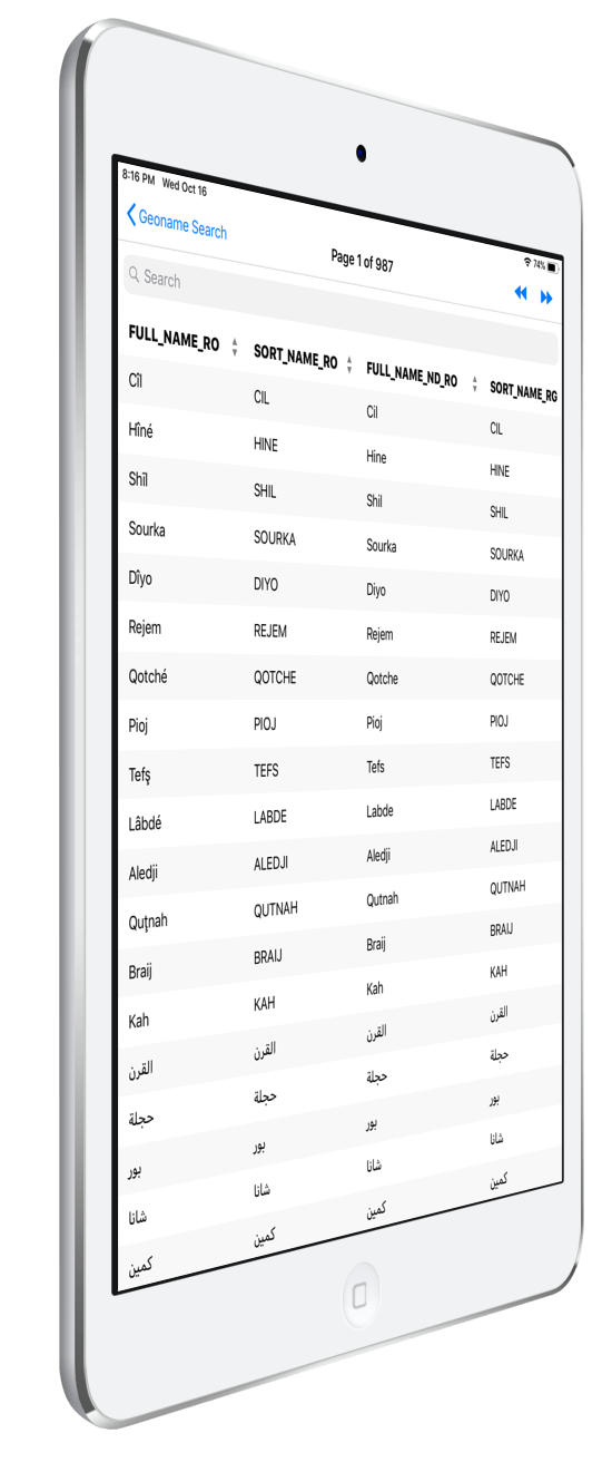
Attribute table/Grid of GeoNames
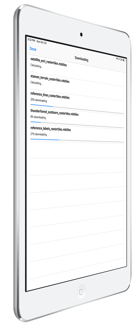
Offline Layer Management
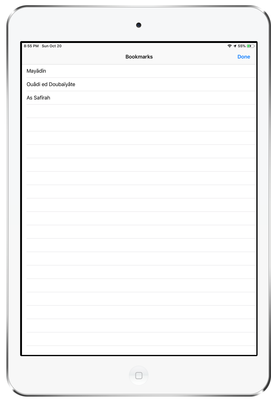
Bookmarks
Bookmarks can be managed from this screen. Go to the bookmark, Delete the bookmark, Export the bookmark to GeoJSON format.
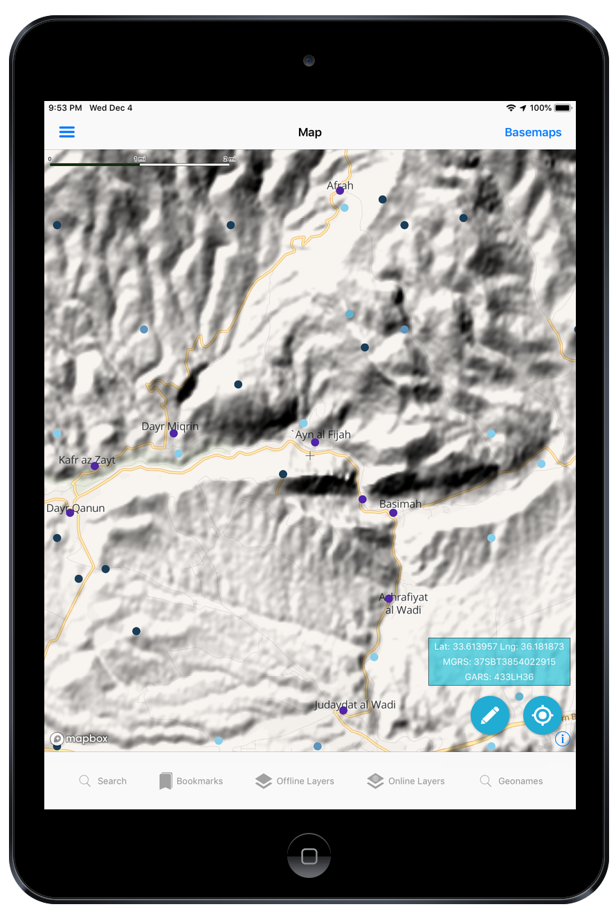
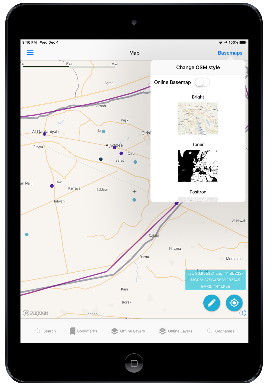
Vector Tile Open Street Map Styles Picker
The app includes support for the following Styles – Bright, Toner, Positron, Dark Matter, Klokantech, Klokantech3D. And 3 styles for use with other basemaps below the OSM vector tiles so those styles have Opactity settings/transpareny for the polygons (Bright, Dark Matter, and Klokantech)
Note: there is a toggle to turn off the OSM Basemap.
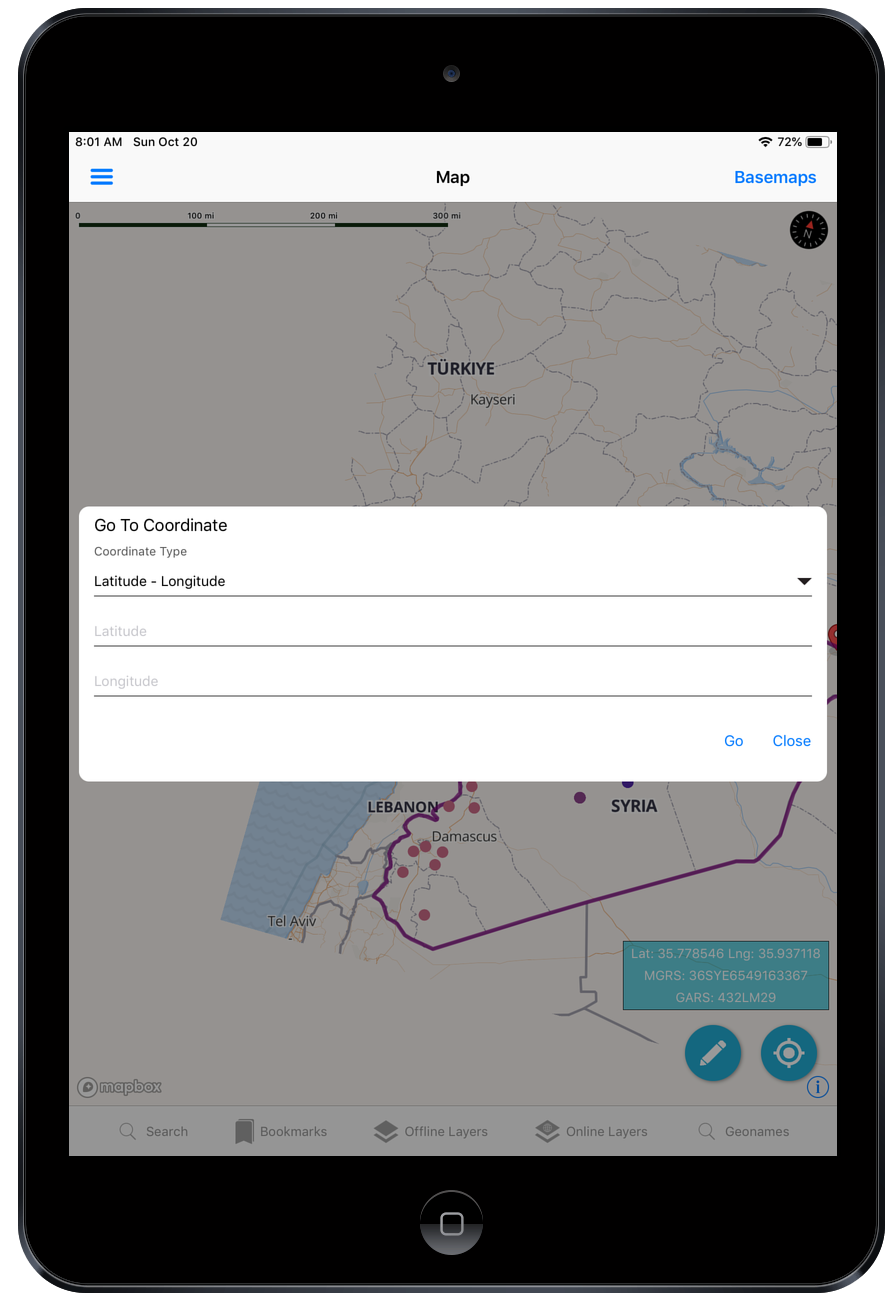
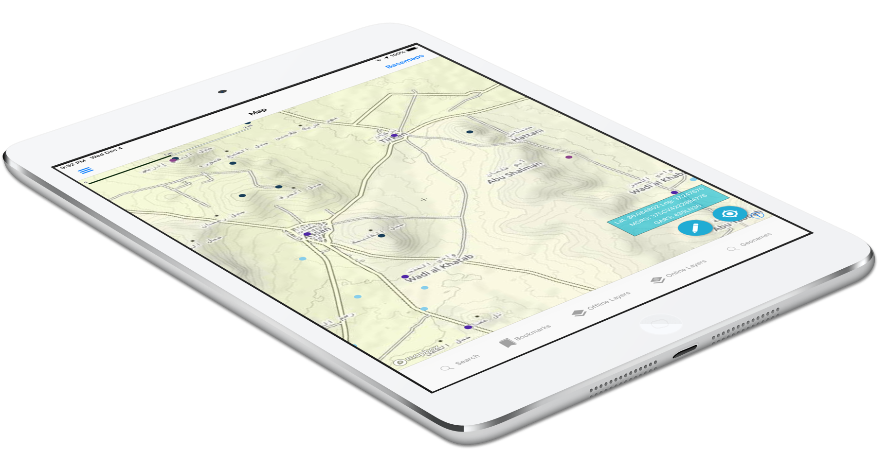
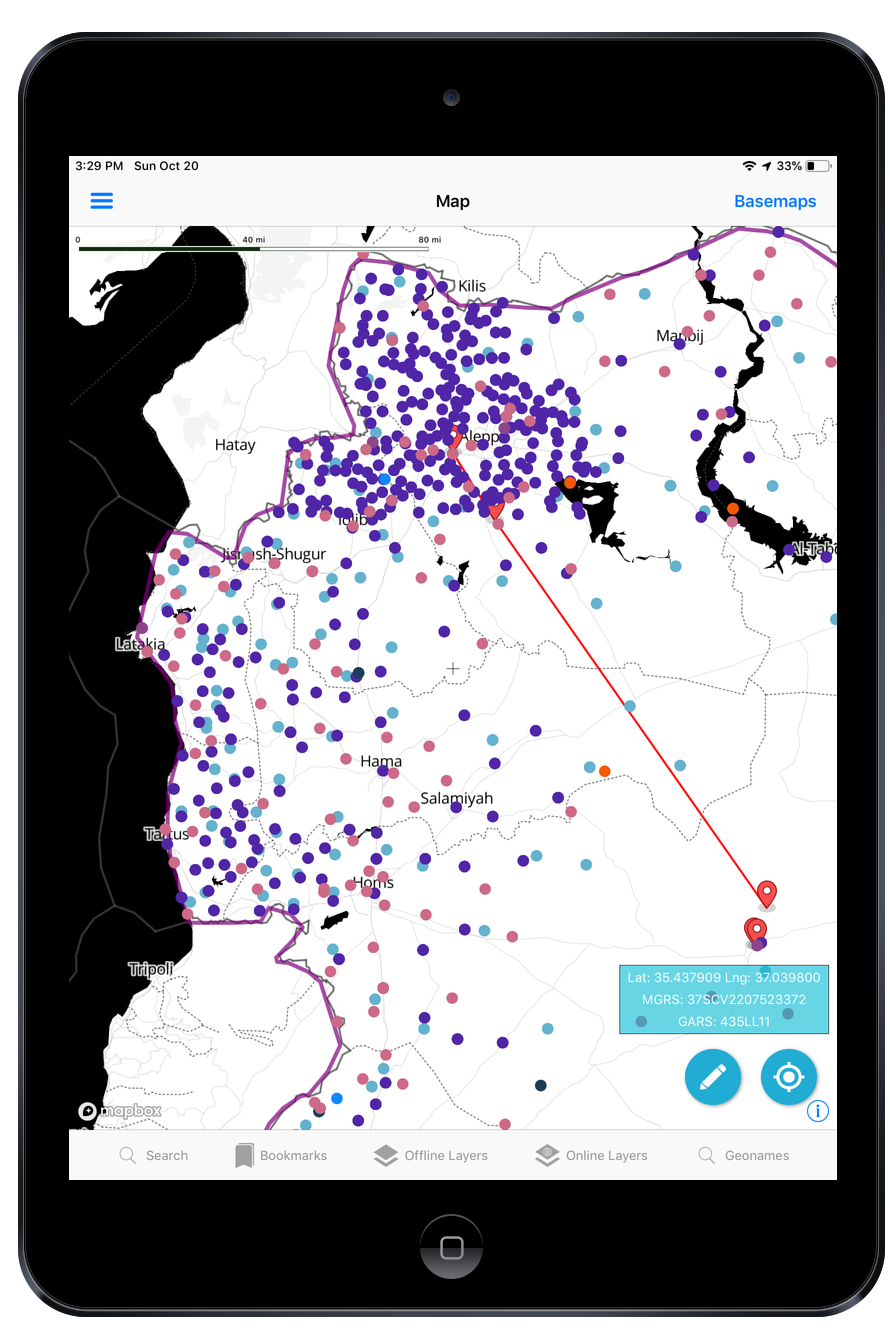
Go to Coordinates
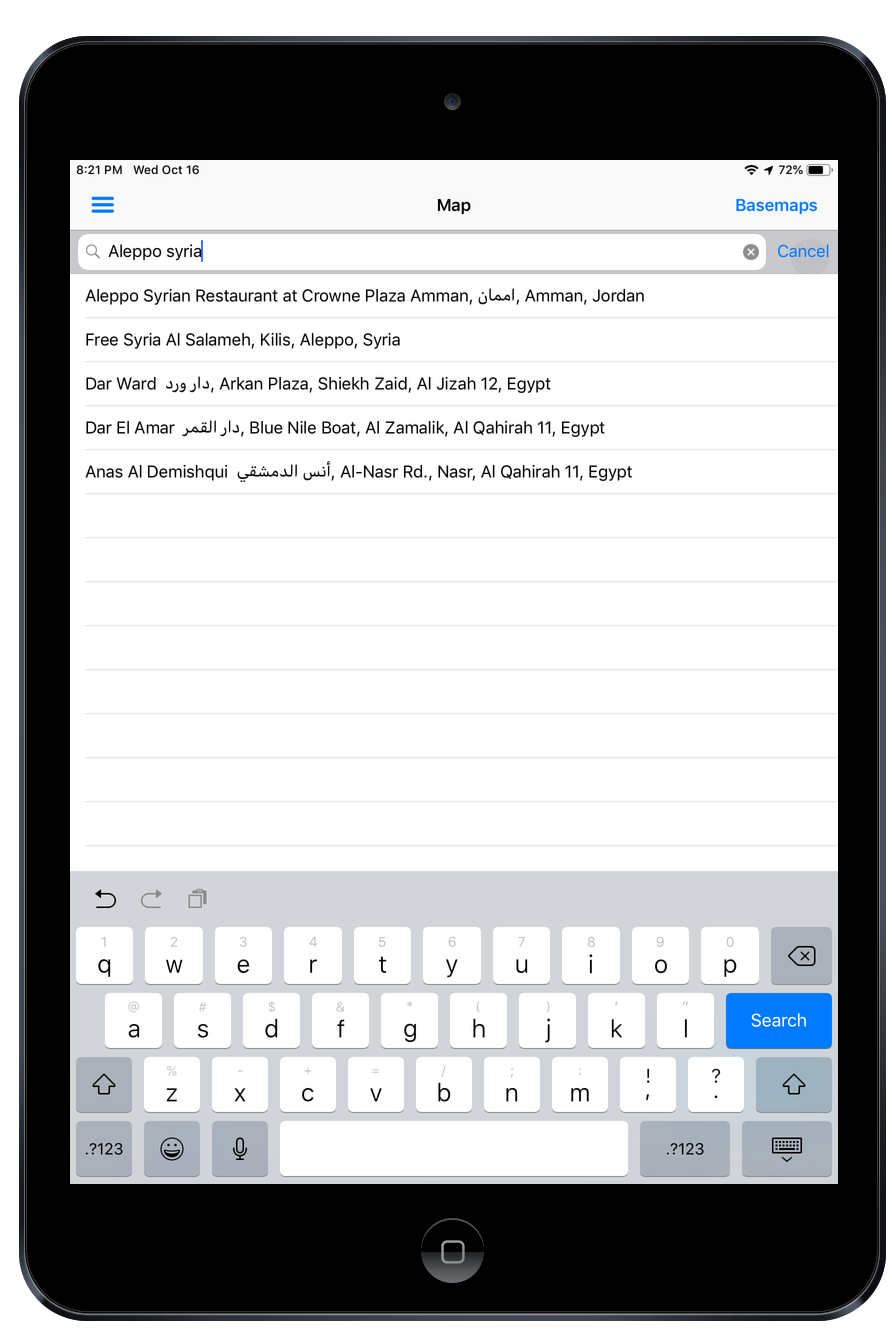
MapBox Search/GeoCoding/Places
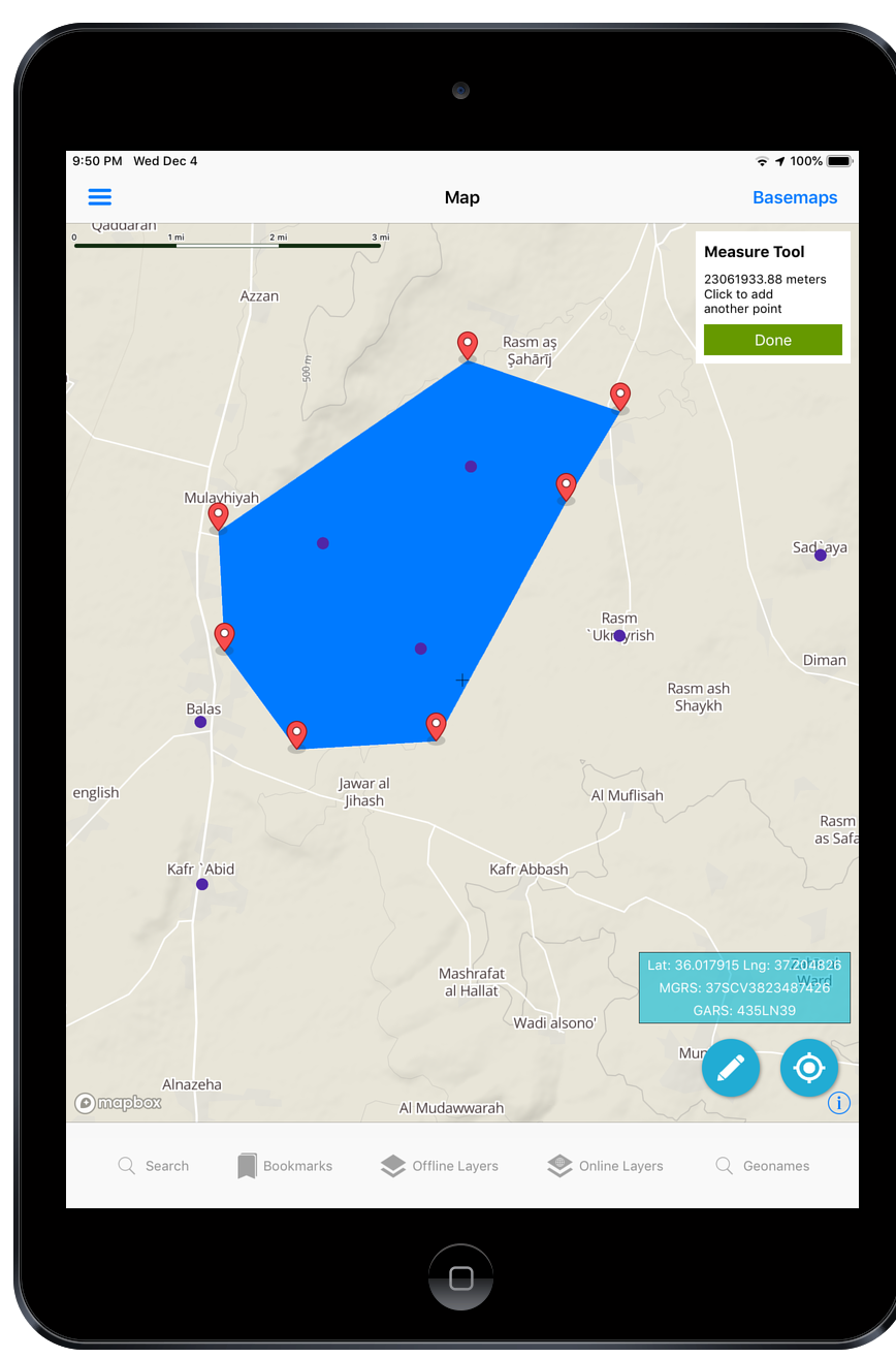
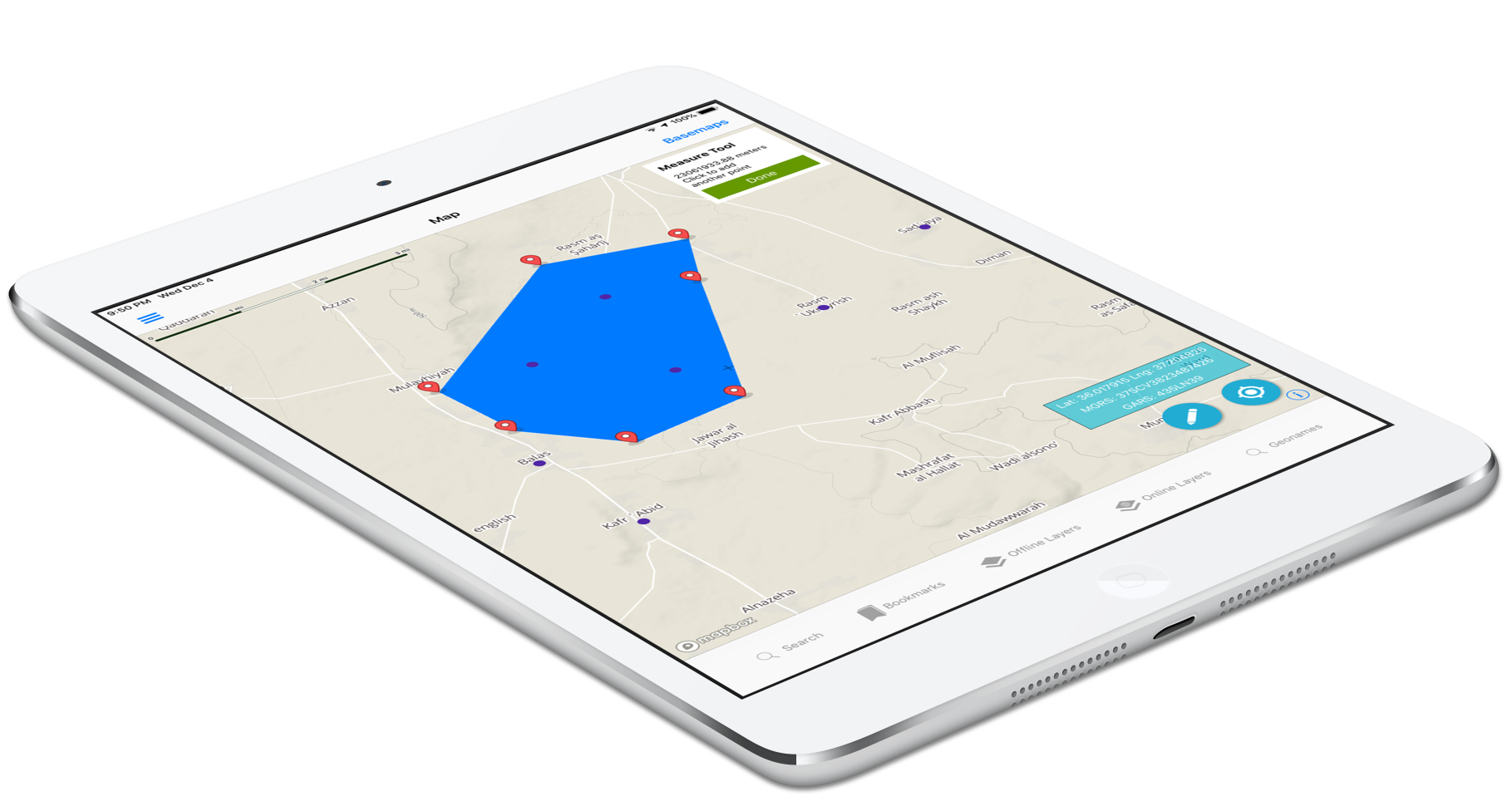
Measure linear and area
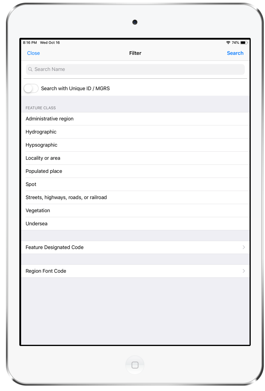
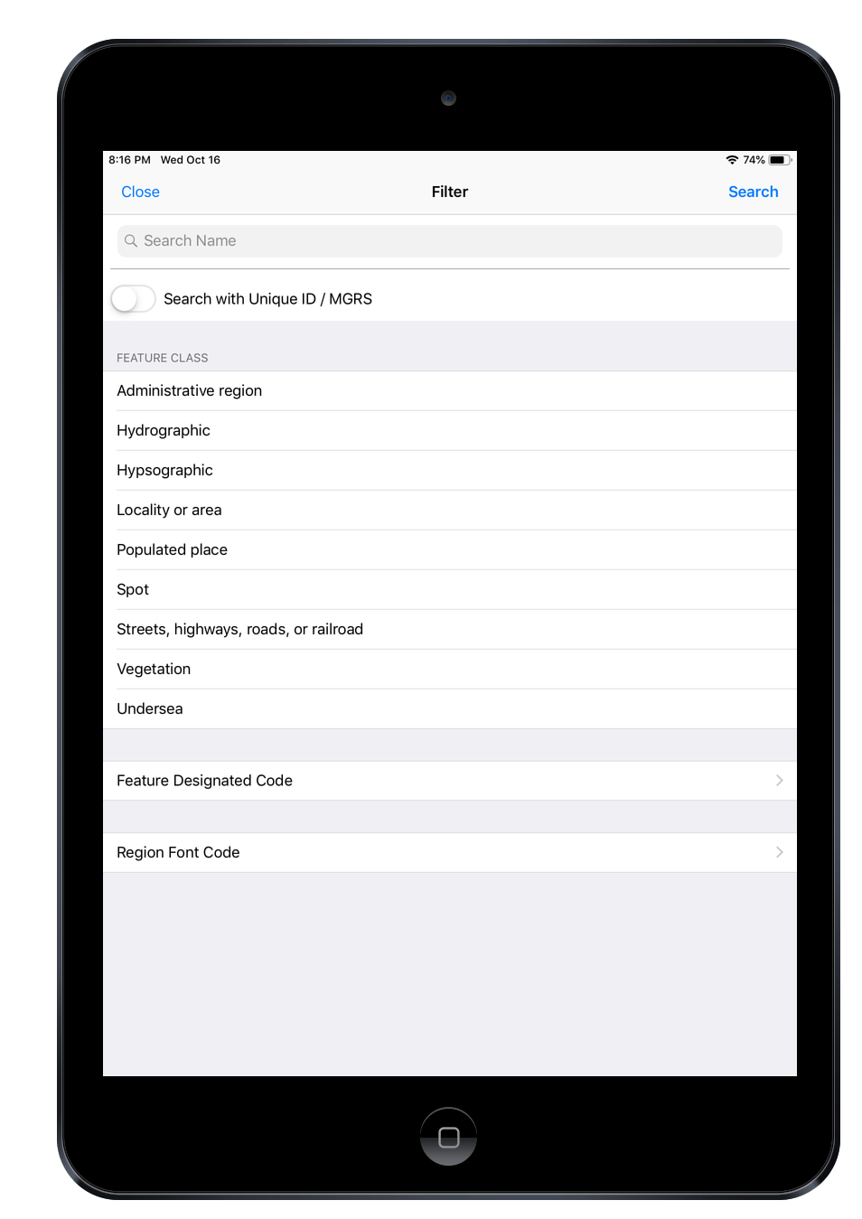
Filtering
You can do a text search, filter by Feature Class and Feature Designated Code
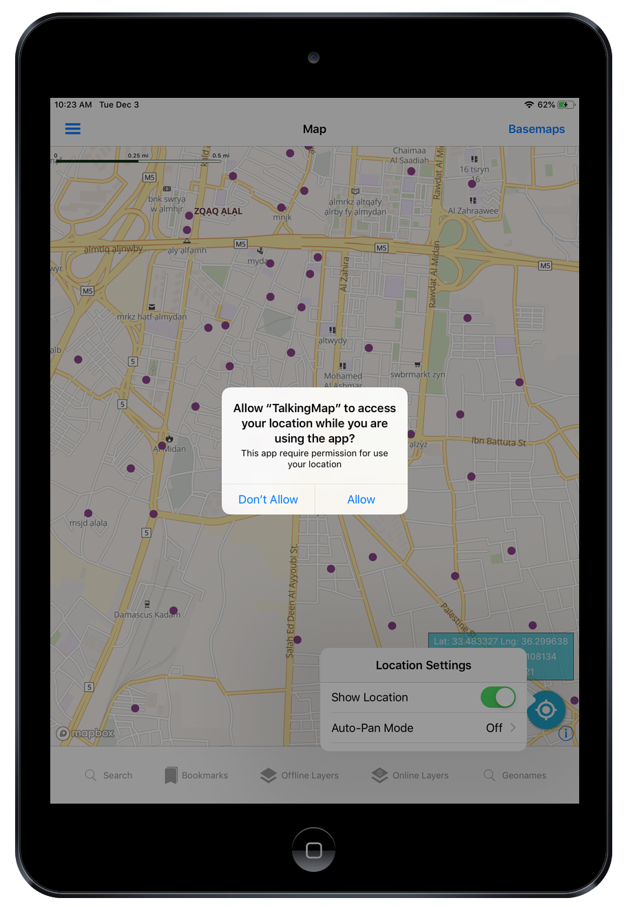
Enable GeoLocation
Show Location on the Map
Move the Map to your location
Map Scale
Both a scale bar in Metric (M or KM) and traditional Map Scale 1:500,000 or 1:50,000 is included as to optionally toggle on.
Popup
In popup ,that feature displays on the map and you can also download geojson of that feature and also finding bearing another feature,finding distance to another feature or point and also add to spatial bookmarks . You can also listen about geoname information with deleting from information list but not from map
Raster Tile Basemap Picker
The App includes Basemaps from many popular Providers some Free and some commercial.
Country Map Data Explorer
We have equivalent app on Google/Apple/Microsoft Called Country Map Data Explorer.

Need Offline Map Data
Talking Map App is the right choice
It’s designed for disconnected limited availability environment with offline map data and databases.
Any Government Personnel stationed overseas, Any Citizen or Traveler to that Country can use this App.
Syria, Afghanistan, Iraq, Pakistan, Yemen, Libya, Lebanon, Israel, South Korea, Eritrea, Somolia, Djibouti