
Build Mapping, Visualization & Spatial Analysis using ArcGIS Runtime SDK for .NET
A Powerful Mapping Tool for Universal Windows Platform (UWP)
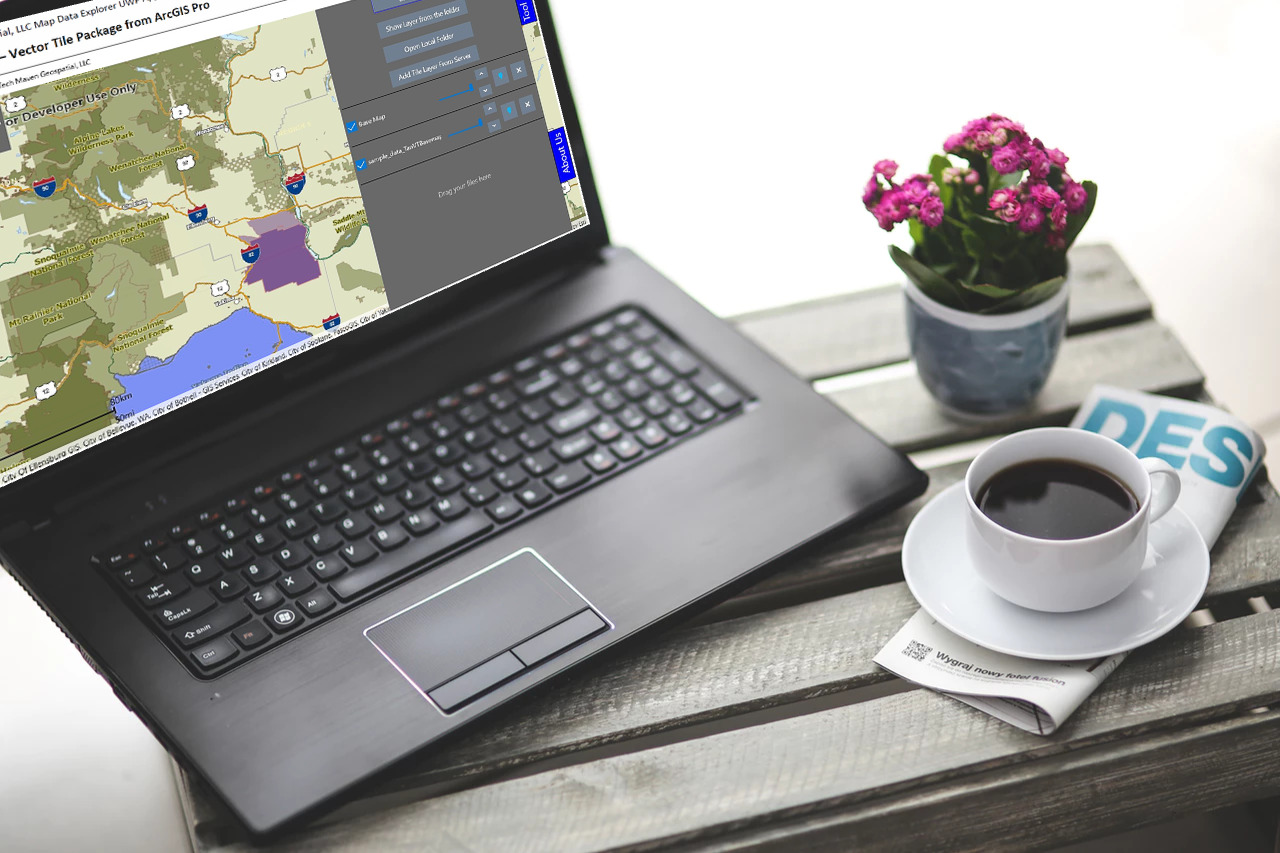
Cross-Sell Windows Tile Server
Pair with Windows Tile Server application for a data serving module to serve (MBTILES, GPKG and Folder of TMS/XYZ Tiles Vector Tiles, Raster Tiles, Elevation/Terrain Tiles) and also does vector tiles 2 raster tiles and blending /merging and Localhost WebServer to serve local GIS files like KML/KMZ to the map as if they are coming from the internet. The great thing about this module is that can License from ESRI with BASIC instead of STANDARD to support local file handling because they are from http. In addition, this module has Nettopology Suite and Spatialite for GeoPackage vector features with spatial functions/operations as well as ability to convert Projected shapefiles and other formats to KML via the ExportKML function. (even for just what’s in view to keep file small and to request new file for each pan/zoom)
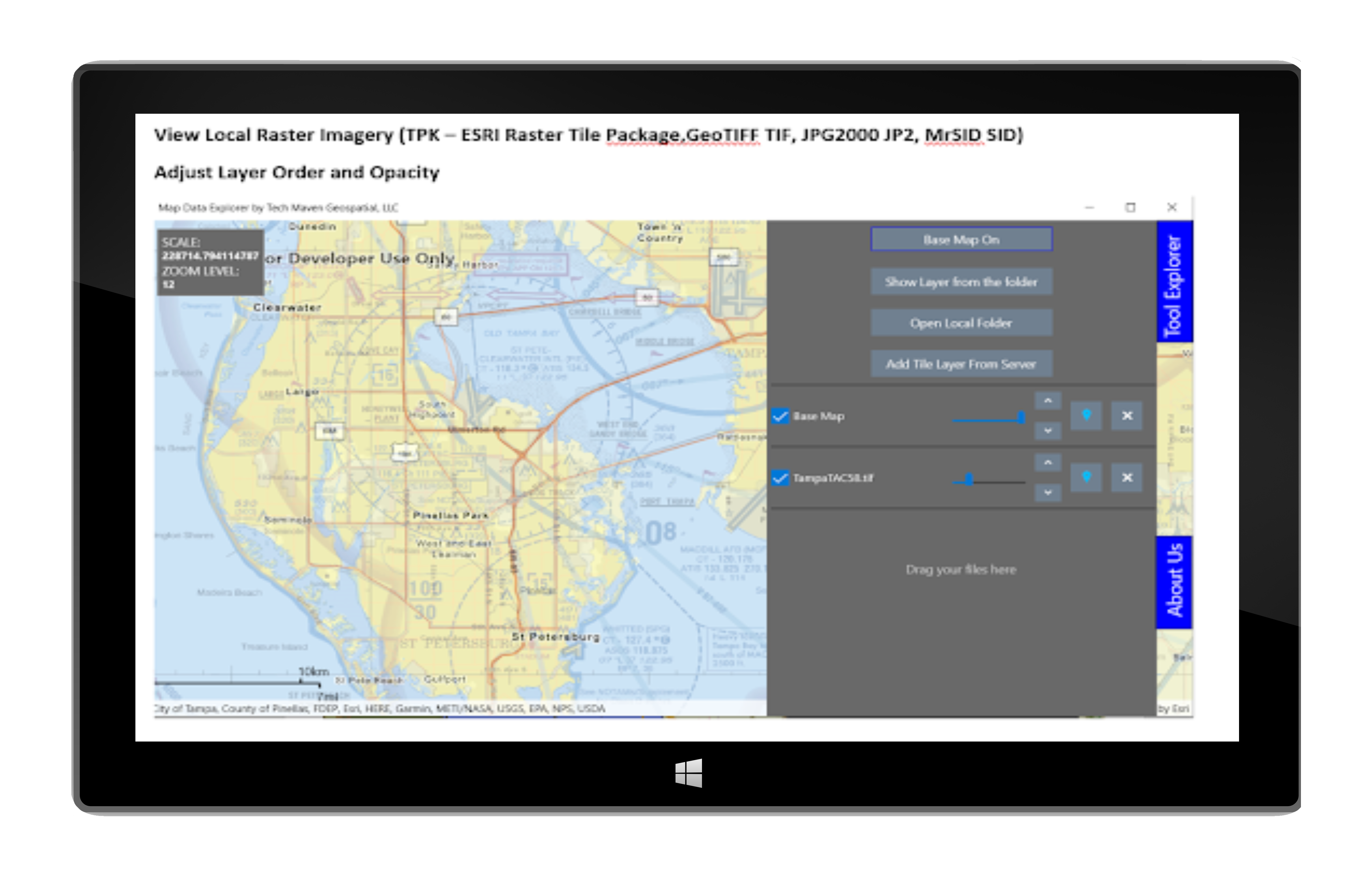
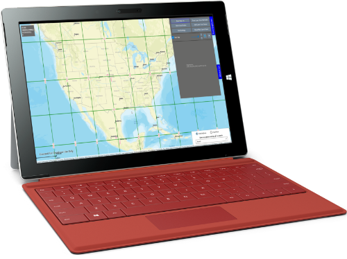
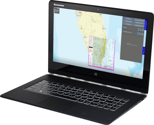
Map Features
Zoom to extent
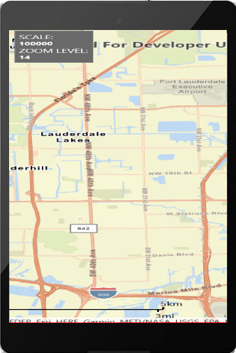
Display Map Scale
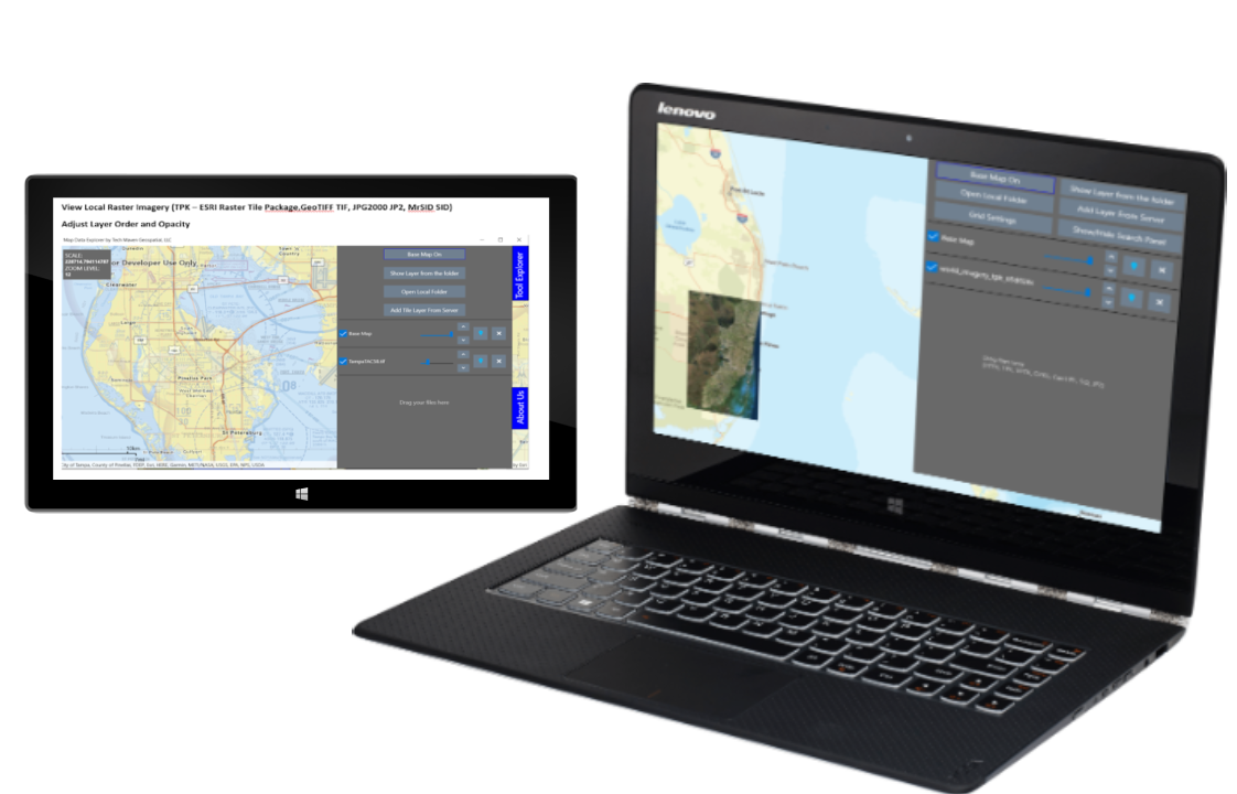
Adjust Opacity
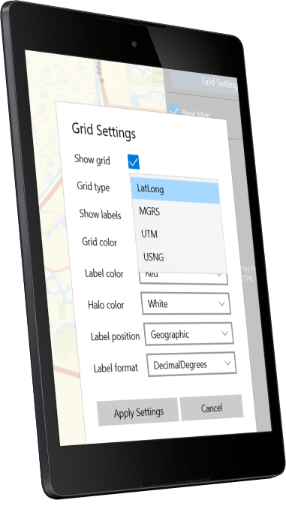
Grid Settings
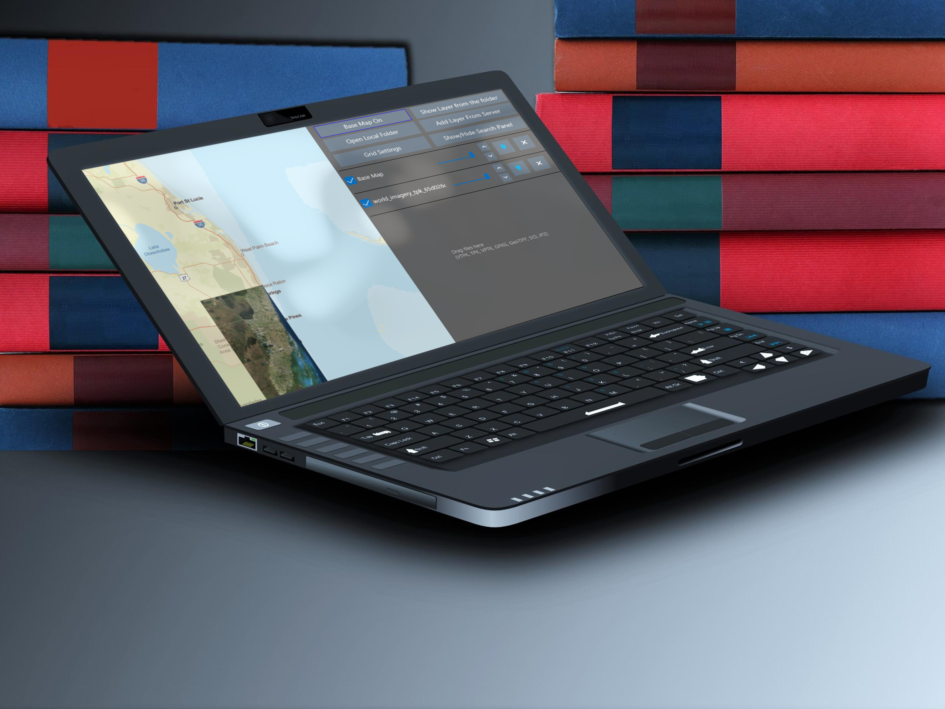
Re-order/Delete Layers
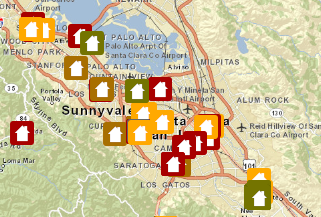
Find Addresses or Places
ESRI Offline Package Format Support
TPK and TPKX Raster Tiles
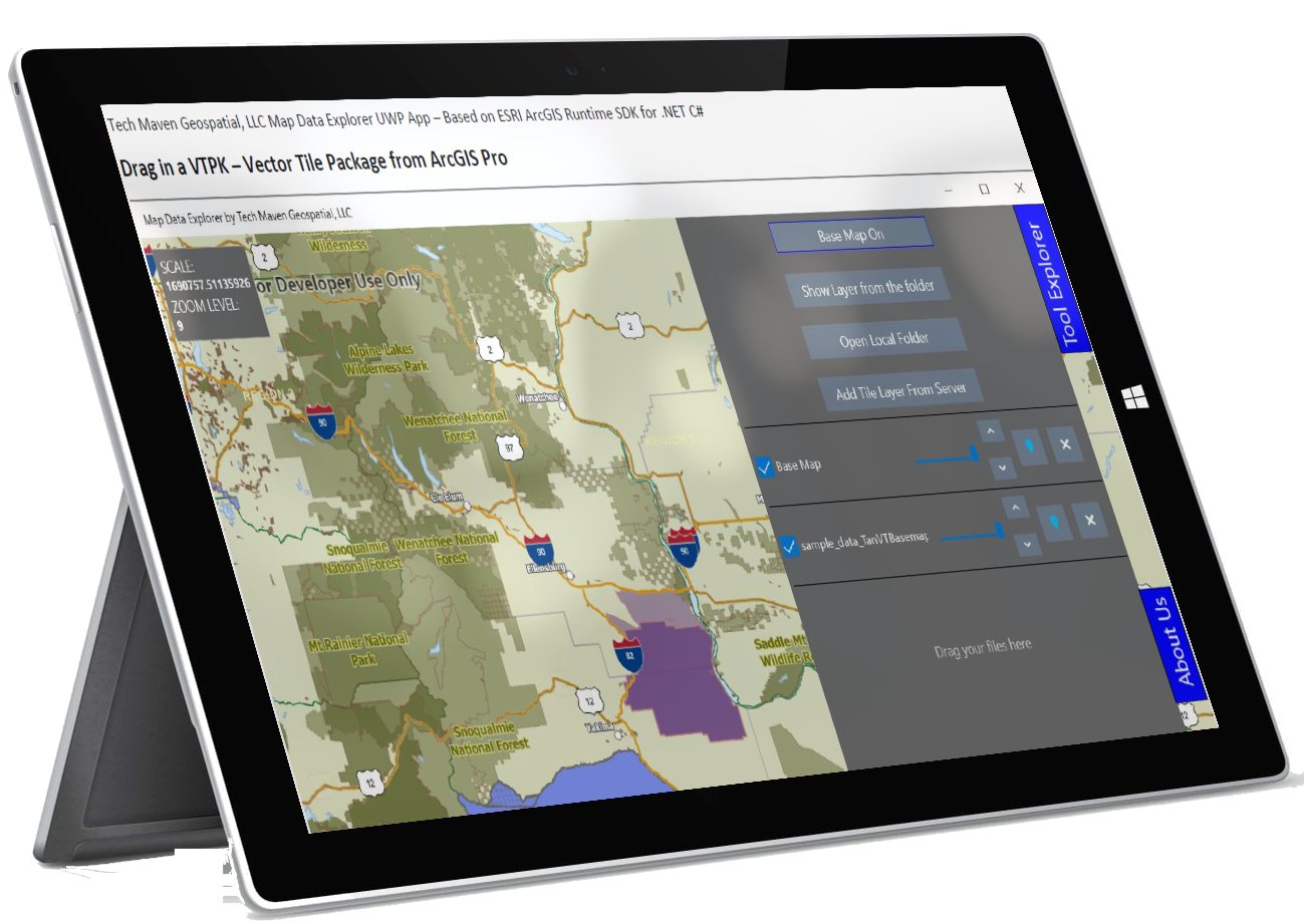
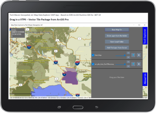
VTPK
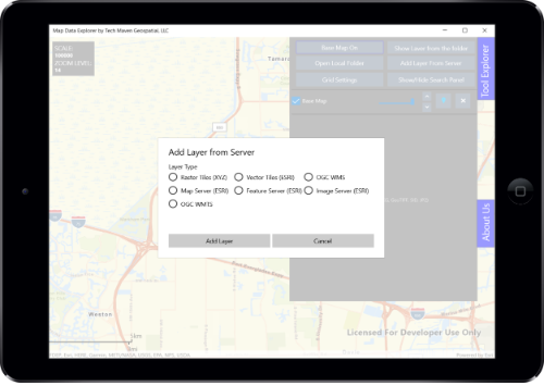
Access internet map services from many sources
Can fully support NITF RPF-Raster Product Formats raster formats (ECRG,CIB, CADRG,ETC).
Can easily add MILSPEC 2525D App6 symbology

Can easily add offline line of sight and viewshed
Raster Imagery (TIF,SID,JP2)
Standard Runtime Licence
OGC GPKG - GeoPackage Raster Tiles and Vector Features
Supported Formats
We can easily add support for the following very difficult formats: ENC layer – Electronic Nautical Chart Vector data
All of these raster Imagery Formats:
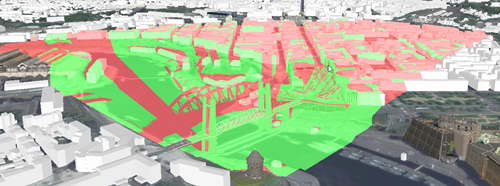
Analyze Visibility
Visibility analysis means determining which areas or specific features are visible from a hypothetical observer (location, heading, field of view, and so on).
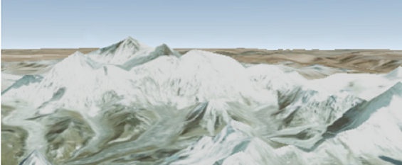
3D Perspective Scene View
Scenes are the fundamental document type used for persistence and sharing of 3D content across the ArcGIS platform.Add a surface layer to a scene with a basemap for 3D visualization.
Editing Data /Creating Data
Updating features includes modifying feature attributes (changing the value of a feature’s fields according to the type and range of values allowed); modifying feature geometry (such as moving a point feature or reshaping a polygon or polyline feature).

Future support for Mobile Map Package (.mmpk)
Display map grids, view secured services, and works offline with support for Mobile Map Packages. (note: Offline Mobile Map Package support
GeoProcessing and Consuming GeoProcessing Web Services
A geoprocessing tool is a command or function that performs an operation on GIS data.
Support Scene Layer Package (SLPK ) Support Mobile Scene Packages (.mspk)
An .mspk file is an archive containing the data used to display an offline 3D scene. Some mobile scene packages have data that must be unpacked before reading.